 Walleye
 Northern Pike
 Lake Trout
 Brook Trout
 Steelhead
 Salmon
 Smallmouth Bass
 Perch
Perch Superior Picnics
Lake Superior Archipelago
Back to Superior Country BlogNestled at the top of Lake Superior a group of islands are waiting to be discovered. But first how do you promote an activity on Superior waters when the biggest story in the last half-century was the sinking of the Edmund Fitzgerald? Where do you begin when a lake like Superior has many moods?
How do you navigate planning in this area when services are far and few between? Well like all big adventures you take it, a bit at a time, and prepare yourself for an amazing panoramas of an untamed frontier.

Early in the season, you might need to watch out for melting flows of ice, but as the season progresses, the adventure opens up. For within Superior, with it’s many islands, bays and nooks there is always something waiting to be seen, experienced or explored. Take for instance the clean clear turquoise water with no algae blooms to contend with or a swarm of other boats competing for a mooring.
As this area on the top of Lake Superior is now being re-discovered, after a lack of infrastructure upgrades over the years, more investments are being made into the conservation story. The Lake Superior National Marine Conservation Area stretching from Silver Islet in the west to Terrace Bay in the east and is a place for future development. We’ll concentrate our focus on this area, as it harbors many unique qualities making it an attractive destination.
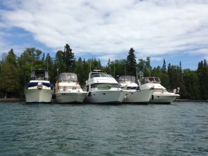
As a boater will quickly share with you, this area is not overflowing with visitors with around 500 boaters per season trawling across the region. The benefit of this is: it’s your place to explore. From the pictographs at Nipigon, the meteoric shard embedded in the Slate Islands, to the pristine beauty of the area. Unwinding at your own mooring spot surrounded by trees, rocks and solitude maybe what you are looking for?
You will often see Moose swimming the waters to find better pastures, peregrine falcons nesting with their young ones on cliff sides and fish jumping out of the water, tempting to be caught. Here you are not only an observer of nature but part of it!
First Checking into the City of Thunder Bay with its full service marina is a good starting point as you can clear customs and fortify your voyage with supplies.
As experienced boaters will tell you, once you start your journey, you connect with other boaters, who share the local hot spots. Some may even find this slightly annoying as suggestion upon suggestion is shared but it’s this type of enthusiasm that helps to guide your journey. Canadian Coast Guard and Auxiliary Coast Guard are stationed across the islands to help if you need assistance.
A new destination 25 miles east of the city and across Black Bay and the start of a 180-mile archipelago of islands is Porphyry Island Lighthouse. Accommodating vessels of up to 40ft with a draft of 8 ft, this lighthouse destination provides a new sauna, interpretive tours, and walking trails to stretch your legs.

The saunas along the north shore of Lake Superior are a unique characteristic of the area as they were used during the logging and fishing days for hygiene, now people do the same, and plunge into the cold waters to test their mettle.
Traveling further into the archipelago you come to further attraction near the Nipigon Straights with CPR slip destination. The area is maintained through volunteer labor, has a sauna and offers a great lookout trail by a quiet bay to relax by. If you choose you can go down the Nipigon Straights, you can resupply at two full service marinas at Red Rock and Nipigon. Each community provides all the services you require.
From here to the east services diminish and require that you plan your route carefully. Some will venture towards Rossport, a quaint hamlet with an accommodating dock, while others may explore the islands further, with their beautiful waterfalls and secluded bays.
Battle Island Lighthouses is also a destination on the outside of the archipelagos and has little amenities but has onsite interpretive signs to help you explore. The docking situation is not very robust, so you might throw out a hook and dingy in.
These areas are great for fishing along the many reefs, and again by talking with locals they might share where you could venture to at least find some satisfaction.
For paddle borders, or for dingy exploring, there are many sites along the shore to sneak into and out of and see old mining claims or shantytowns from logging days long past.
Again locals can point out these spots or boaters you meet along the way. Part of the adventure is to set sail and/or power-up and have a basic float plan. Taking this trip across the archipelago would be on average a week-long affair, most boaters return through the US via Isle Royal or Copper Harbor, which is the shortest cross water crossing.
When planning your journey to the north shore of Lake Superior you can reach out to Superiorcountry.ca and they will provide you with contacts to help you plan. Also referring to Bonny Dhal’s book “Superior Ways” is a great asset to plan a visit and be safely underway.
The shores of Superior will provide you with many new opportunities, what are you waiting for?
